|
| Seen in parking lot of museum. Staff archeologist perhaps? |
Liz here:
We left Moab, Utah and
beautiful Arches National Park on Friday, Sept. 21, and drove 130 miles to the
Mesa Verde RV Park just outside the national park. This RV park deserves its high
rating. It is as nice an RV park as we’ve ever stayed in, run also by Liz and
Mike. Shady trees line the RV sites and a gas stove heats a cozy outdoor
conversation pit where many a group has sat to discuss the amazing artifacts in
Mesa Verde. I swam in the pool and then soaked in a hot tub with a family from
North Carolina. They told me about that
evening’s dirt track races. Good idea! So Mike and I had a Mexican dinner in
Cortez and went to the races at the nearby Montezuma Fairgrounds after dinner.
I’ll let Mike elaborate on the car races.
Mike here:
There's nothing quite like a semi-pro dirt track race on a 1/4 mile bullring. Absolutely nothing up to NASCAR standard here. The stands were hard wood, the refreshments limited to hot dogs grilled while you wait and watery colas, the sound system full of crackles and drop-outs, even the track was sub-par, inadequately watered and breaking up by the feature. Consequently you couldn't see the cars by the tenth lap of any of the races. Because the lighting was so poor, the pictures I took show just a dusty blur of cars going by. I have no idea of what the drivers were using for vision!
 |
| See what I mean? |
Liz again:
We set the weekend aside to
relax. Mike watched football, golf and NASCAR. On Saturday I washed the dust
off the truck and spent Sunday playing on the internet. I read Superfreakonomics, talked on
the phone, cooked and sent out a few postcards. (Sean, we thank you so much for
the memory stick with books that Fred passed onto us from you.)
Sunday morning we drove the
18 miles into the Mesa Verde. The drive alone is a drama. In the Visitor’s
Center we were introduced to learned a young Finnish archeologist, Gustave
Nordschiold who scientifically excavated and documented Mesa Verde in 1870s.
When he boxed up artifacts to take to Finland the locals were horrified. The
sheriff put him in jail but no law was in place to prevent the taking of
artifacts. The Antiquities Act wasn’t passed until 1906 when Teddy Roosevelt
established the park. After release from jail he returned to his home in
Finland where the artifacts are in a museum there to this day. He married, had
a child and died of TB at the age of 26.
 |
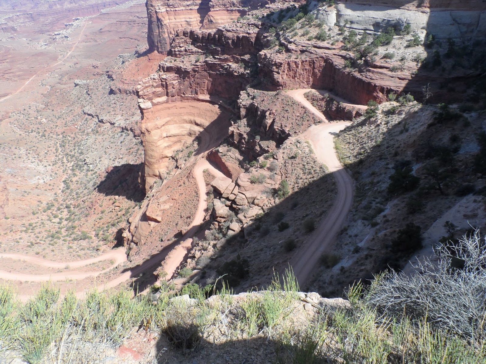
| See that squiggle? Look up above it, there's even more. It's part of the road. |
In Mesa Verde we visit Cliff Palace and Balcony House on ranger guided tours that cost $3.
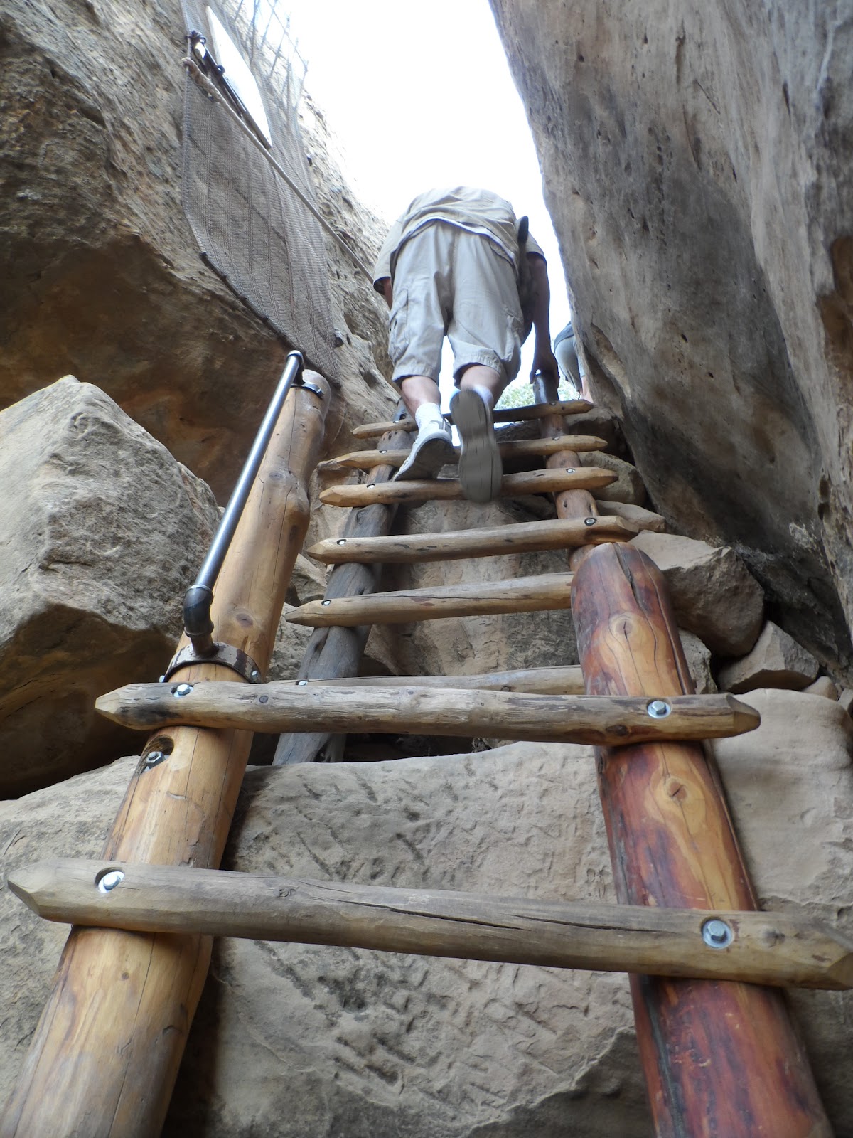
On Monday a very erudite US
Park Service ranger toured 30 of us through the Cliff Palace. The rangers’
first task is to describe the complex tour ahead so thoroughly as to dissuade
anyone unfit to turn back. The task of climbing and pushing one’s body through
openings on long ladders is not for the frail or for those afraid of heights.
We hiked a mere ¼ mile in total but we climbed 5 8 to 10 foot ladders including
a 100-foot vertical climb to the exit. Our tour included a group of Germans
with an English translator. In true German fashion they were most curious and
concerned about animal life in Mesa Verde. We saw lizards, deer and ravens. The communal room is called a kiva. It is the name of round spaces below.
 |
| Cliff Palace from across the canyon. Lots of round spaces make this a palace. |
 |
| Closer. Also our very knowledgeable ranger, the only way to see this site and Balcony House, mostly because access to the ruins is so strenuous. |
 |
See what I mean?
I have no idea how Indians did this! |
 |
| Kiva, a ceremonial room. Pueblo Indians still use this basic form. |
Mike again:
Mesa Verde is all about a vanished people. From 600 - 1275 AD this was a flourishing community. Then everyone just up and left, leaving all kinds of possessions and artifacts in their cliff dwellings. Their descendants, Keresan, Hopi, Tanoan, etc. know all about the exodus but have no idea why. Archeologists can trace their developing culture, agriculture and technology almost year by year and then come to a dead stop with their disappearance.
Typically, we started with the last first. Cliff Palace and Balcony House along with Spruce House are the last of the civilization chain. Apparently the reason for moving into the cliff alcoves had to do with water, always a problem here. Winter snow and rain would seep through the porous sandstone until stopped by a less permeable layer of shale. Coincidentally, these shale layers also contributed to erosion of the sandstone. Thus, many large alcoves automatically had a water source. Hard to get to but spectacular. Okay, I'll shut up and show some more amazing pictures.
 |
| Spruce House. Note the multi-stories going right up to the top of the alcove. |
 |
These are original 13th century floor joists. The steel turnbuckle above them are holding the structure together.
Though the stonework is superb the mortar has deteriorated. I wonder how our brickwork will look after 600 years? |
 |
| These beam-ends were hewn 600 years ago with stone axes. |
 |
| Liz descending into a restored kiva. |
 |
Tourist standing along wall of Balcony House.
This is the only concession we saw to the sheer drops adjoining the cliff dwellings. |
 |
| Mostly, its a sheer drop like this. |
Of course, earlier constructions, up on the mesa were in nowhere near as good a shape. Also, it looks as though the cliff dwellers raided them for building materials.
 |
| Remains of a 7th or so century pit house. The roof was bent poles and mud with a smoke hole in the center. They were apparently firetraps. Later houses used vertical stone walls, quite similar to Pueblo houses of today. |
 |
| All that's left of a mid-period village. Remains of villages like this are all over the mesa. |
After a few days of climbing up and down cliffs we figured we were up to the challenge of seeing the petgroglyphs. I have no idea why these ancient people decided to decorate the hardest to get to areas but there you are. A 2.8 mile walk with a thousand feet of elevation change, the first mile and a half pretty much along the canyon face. Very cool but pretty damn strenuous.
 |
| Right through there, if you please. |
 |
| We couldn't really complain about this section. There WERE steps! |
 |
| Somewhere on the left hand side of the picture is more of the trail. |
 |
| On the other hand, the rock writing is definitely worth the walk. |
 |
| Pueblo art showing skunks with a bear on the run. |
Our last day at Mesa Verde we decided to take a road trip along the Trail of the Ancients to Hovenweep National Monument. More cool ruins, though very different architecture. This site holds 5 different small villages built late in the old people's stay in the area. After that, we got just a bit lost and somehow ended up at Four Corners, the only place four states meet.
 |
| Typical Hovenweep ruins. The house at the lower left seems to have been built in a hollow boulder. |
 |
| Standing in the ruins of one village with another just across the canyon. |
 |
| Many of the houses seem to have a round room. |
 |
| Standing in 4 states at once! Utah, Colorado, New Mexico and Arizona |
A digression. While looking through Walmart (No, I don't necessarily approve of Walmart but I do take advantage of their hospitality for free overnight parking and they do have RV supplies and automotive stuff) I saw a bewildering variety of diesel fuel supplements, most containing cetane. While googling it, I came upon the Duramax Forum. They had a good discussion of fuel additives and a list of some that were not approved by GM along with a consensus of which were best. I had no idea that low sulfur fuel (required since 2007) did not lubricate fuel pumps and valve guides as well as the old stuff. Also that diesel fuels were quite variable in their cetane content (cetane is roughly equivalent to octane in gasoline). Anyway, I couldn't find the additive they most highly recommended, Opti-lube XPD, but Walmart did carry the second best, Diesel Klean. My unloaded fuel mileage immediately went from an abysmal 16 mpg to a much more acceptable 19 mpg. Loaded with trailer, I went from 10-12 mpg to 12-14 mpg. Only took 13 thousand or so miles to find it!
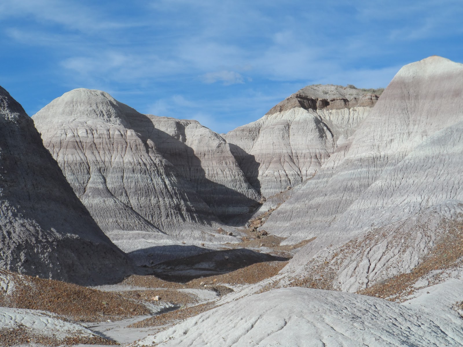
We took off early from Mesa Verde aiming roughly for Meteor Crater but there were a couple of attractions on the way worthy of attention. We headed south and west out of Colorado (I have to keep pinching myself, I'm actually in the Great American Southwest!) through Gallup and stopped at the Petrified Forest National Park that just happens to be in the Painted Desert, a spectacular stretch of badlands that stretches for Las Vegas to the Four Corners. 225 or so million years ago when reptiles ruled the earth and dinosaurs were just becoming the killer app, the area was wet and tropical with an Amazon-like river running through. Dead trees would be swept down the river and deposited on the outside of bends and buried in sand. Of course, petrified wood is found all over the world but nowhere else in this profusion nor with this kind of chemical infusion. Quartz infused with iron, manganese, uranium and other heavy elements and produced a rainbow of colors. Kind of like the hills surrounding them. Not to mention all kinds of Triassic fossils in these hills. Oh hell, on with the pictures.
 |
| Shiprock, namesake for Shiprock, New Mexico. |
 |
| The Painted Desert. What else could you call it? |
 |
I mean, really?
By the way, much of what you see here is bentonite with different chemical traces.
Bentonite is commercially available as Dri-Rite and many brands of kitty litter. |
 |
Just because I can't help myself.
Look closer, there are several petrified logs and that lower slope, all small bits of petrified wood. |
 |
| There is not a natural rock in this picture, it's all petrified wood! |
 |
| And a lot of it is really colorful. |
 |
| One area in particular had some huge specimens. |
 |
Not a dinosaur but a much older reptile herbivore.
All the fossils in the visitor's center were found nearby, many remarkably complete.
The Park Service maintains a staff archeologist, paleontoligist and biologist. All very busy people. |
We ate up the entire day and still hadn't seen all we wanted. No problem. On the south side of the park is a rock shop that welcomed casual campers. Met a really nice couple from Alabama and spent the evening chewing the fat. This is not an isolated ocurrence. Makes travelling that much nicer.
 |
| In the rock shop. One of these slabs will set you back a few grand. They mine their own off park property and slice and grind it themselves. |
Of course, that meant we felt obligated to patronize the shop in the morning. Picked up a few small pieces of petrified wood (just little stuff, not what the picture shows), postcards, etc. and finished up the park. God Bless that free pass for seniors.
Today we're parked in Homolovi State Park in Az. Some more ruins, tiny compared to what we've been seeing but this time with lots of pot shards, flint scraps. Ran into yet another retiree and spent the afternoon in conversation. While watching the Ryder Cup (Hey, sometimes you luck into a little luxury) Liz looked out the door. A roadrunner was investigating our camp. He ended up getting curious and jumping on our doorstep before wandering off. Later Bob, the retired California State Patrolman I mentioned earlier showed off a dead 2 1/2 foot rattlesnake he'd found just down the road. Life can get very interesting!
 |
| Scraps like this littered the ground all over the site. |
 |
| A smooth river cobble. A flint working tool? |
 |
The most complete foundation on the site. One of a hundred or so rooms arranged around two central plazas.
Again, abandoned around 1300. |
 |
| Curious Roadrunner paid us a call. |
 |
| Up close and personal on our steps. |
 |
| Rattlesnake. Bob got the rattles |
 |
| Camping in the desert. |
Next, Meteor Crater.